Post by Forum Admin on Jun 21st, 2011 at 4:07pm
Simple antennas, such as global beam horn or circular feed horn and circular parabolic reflector, produce circular beams where the power tapers away, increasingly rapidly, as you move away from the beam centre. ĀAround the beam centre, within the -1 dB contour, the beam is fairly flat. Beyond the -4.5 dB contour, the slope becomes quite steep.
It is possible to produce elliptical beams using elliptical feeds and elliptical outline shaped dishes. ĀThis is helpful if you want to illuminate a country that has an elongated elliptical shape, as seen from the relevent orbit position.
It is possible to produce complex shaped beam patterns, to closely match the intended territorial area, by either having a parabolic dish plus multiple feeds or by having a single feed and a deliberately distorting the dish surface.
The use of a multi-feed array, such a 4 x 4 square array, all in use, might produce a square pattern on the earth, with a very flat top, surrounded on four sides by steep slopes, as seen from the satellite. Care needs to be taken to distribute the power from the satellite output ampifier to all relevent feeds in the correct amounts and with correct phase angles so that the resulting pattern is as required.
More complicated feed arrays are possible with different feeds connected to different amplifiers, or even each feed with its own amplifier. The idea being to produce multiple shaped or circular spot beams and reuse the same frequencies several times.
The use of a deliberately distorted dish surface to produce a shaped beam has lower losses (as it needs no splitter/combining network) and would suit a satellite intended for a specific coverage.
Have a look at some more examples views of the earth from the geostationary orbit and invent your own suitably shaped beams to cover your area of interest. The earth is about 17 deg diameter so you can design your (simple) circular satellite antenna using my antenna beamwidth calculator: https://www.satsig.net/pointing/antenna-beamwidth-calculator.htm
wxw
Best regards, Eric.
It is possible to produce elliptical beams using elliptical feeds and elliptical outline shaped dishes. ĀThis is helpful if you want to illuminate a country that has an elongated elliptical shape, as seen from the relevent orbit position.
It is possible to produce complex shaped beam patterns, to closely match the intended territorial area, by either having a parabolic dish plus multiple feeds or by having a single feed and a deliberately distorting the dish surface.
The use of a multi-feed array, such a 4 x 4 square array, all in use, might produce a square pattern on the earth, with a very flat top, surrounded on four sides by steep slopes, as seen from the satellite. Care needs to be taken to distribute the power from the satellite output ampifier to all relevent feeds in the correct amounts and with correct phase angles so that the resulting pattern is as required.
More complicated feed arrays are possible with different feeds connected to different amplifiers, or even each feed with its own amplifier. The idea being to produce multiple shaped or circular spot beams and reuse the same frequencies several times.
The use of a deliberately distorted dish surface to produce a shaped beam has lower losses (as it needs no splitter/combining network) and would suit a satellite intended for a specific coverage.
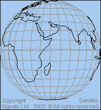
Have a look at some more examples views of the earth from the geostationary orbit and invent your own suitably shaped beams to cover your area of interest. The earth is about 17 deg diameter so you can design your (simple) circular satellite antenna using my antenna beamwidth calculator: https://www.satsig.net/pointing/antenna-beamwidth-calculator.htm
wxw
Best regards, Eric.