Satellite maps: geostationary orbit views from 130 to 180 deg west longitude: Pacific Ocean Region
View point height = 35786 km above the equator. For each map the Sub Satellite Point is on the equator at the same longitude as the satellite. Elevation angle to the satellite is zero at the map edge.
This area is sparsely populated and satellites provide vital links for many remote islands. This part of the geostationary orbit arc is called the Pacific Ocean Region (POR). Three satellites, spaced about 120 deg apart can provide 'Global' coverage.
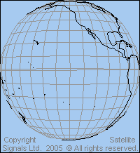 View from above 130 deg west longitude |
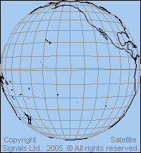 View from above 140 deg west longitude |
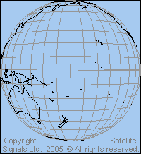
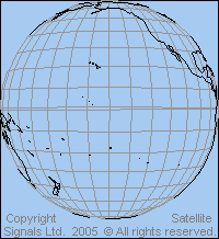 View from above 150 deg west longitude |
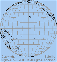 View from above 160 deg west longitude |
 View from above 170 deg west longitude |
 View from above 180 west longitude |
Satellites in the above orbital arc provide largely for international communication between Pacific Islands. Use is also possible for international links between Canada, USA, Caribbean and South America and Japan and Australia, although high capacity optical fibre submarine cable is preferred if possible.
Many thanks to Christian who pointed out that the wrong satellite view maps were showing on this page. Hello Eric! Nice website...But.... You realize that all the orbit view maps on the "120-180deg" page are off by something like 60 degrees of longitude? Cheers Christian. Now corrected oops !
Links: Details of beam coverage maps for particular satellites for America and the Caribbean
and satellites for Asia Pacific
|
► Page created 4 October 2005, amended 18 Sept 2021, 10 May 2026. All pages on this satsig.net web site are Copyright Satellite Signals Limited © 2005 all rights reserved. |