|
|
Galaxy 16 satellite, downlink coverage beam footprint map
The map image on this page is provided to illustrate the service area in more detail.
For more information about Ground Control and fixed VSAT, mobile, portable and maritime mobile satellite communications go to www.groundcontrol.com or call: (US) 800 773 7168 or +1 805 783 4600 or email sales@groundcontrol.com
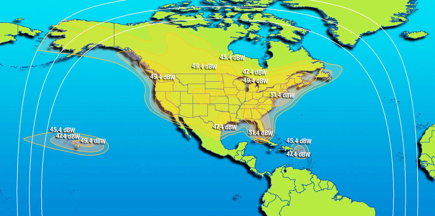
The Galaxy G16 satellite is located at 99 deg west orbit longitude position. You may click the image to obtain a slightly larger high resolution image (note 224k bytes jpg). The outer pale blue lines show the 0, 5 and 10 deg beam elevation contours. Operation below 10 deg elevation is not recommend due to signal level variations due to scintillation and
|
Page started 15 Feb 2010, ECJ Amended 7 March 2023. Updates and corrections to me please at eric@satsig.net |