|
Sep 23rd, 2009 at 9:01am
This image below gives the dish pointing angles for an airfield north of Tikrit, probably COB Speicher or nearby.
Note the blue line which shows the direction of the 21.5 deg east (W6) satellite relative to the buldings.
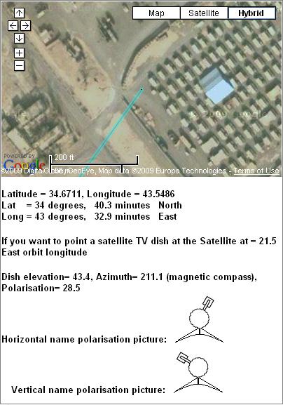
Note the two alternative images of the feed polarisation, as seen with you behind the dish, facing forwards towards the satellite in the sky. Your service provider should have told you what name polarisation to receive.
The polarisation images assume you have an dish with the feed arm at the bottom and set the polarisation by turning the feed/LNB/BUC assembly. If you have the advanced Hughes HX/Prodelin 1.2m arrangement the entire dish has to be turned instead.
If you need help I suggest you look around and search for a similar VSAT dish and ask the people who look after it.
If you are elsewhere in Iraq use this page Satellite dish pointing in Iraq
Best regards, Eric.
|