|
What is at 19 deg North and 99 deg West: Isle of Dolls |
Latitude and longitude explanation |
Manaus location and latitude and longitude (S3°7', W60°1')
What city is located at latitud sur 3°7' longitud oeste 60°1'? Numerous people have been visiting my web site seeking this information.
Typical requests are for "latitud sur 3°7' longitud oeste 60°1'".
Visitors usually go to one of my dynamic latitude longitude finder pages and then drag the map until the wanted lat-long coordinates are showing. They then note the name of the town or city located there.
The Google javascript dynamic maps API process costs me money to provide as they have limits on their free usage and I have to pay once the daily limits are exceeded. I don't know how to charge visitors less than 1p per visit!
This page therefore uses a free non-interactive static maps available from Open Street Map. Their important attribution and link to their website is in the lower edge of the image.
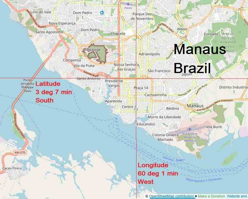
Manaus, Brazil map: latitud sur 3°7' longitud oeste 60°1'
This location is Manaus, a major city in Brazil, South America.
The coordinates of 3°7' S and 60°1' W are expressed in degrees and minutes. A minute is 1/60th of a degree.
I don't know why there is so much interest in finding out what is at these coordinates. If you know please tell me and I will add the story here eric@satsig.net
Do you know anyone else who is searching with the same set of coordinates and why ?
Updated 8 March 2026: I was delighted today to receive an email from a visitor who knew why these "3°7' S and 60°1' W" coordinates were of interest to so many people. Here is the explanation: "These specific coordinates were used in a later season of the popular but somewhat niche TV anime “Dr. STONE” as the point of origin for a “petrification weapon” that engulfed the planet."
If you want a web page with a dynamic map for particular lat/long coordinates try my page satellite view of latitude longitude coordinates. You can see streets and individual houses in Manaus.
|
Page started 21 July 2025, amended 22 July 2025, 8 March 2026. |