|
|
Telstar 11N satellite maps and iDirect and HX services
The Telstar 11N satellite, launched 26 Feb 2009, has 39 Ku-band transponders with various beam coverages over North America, Atlantic Ocean (maritime use), West Europe and Mid and Southern Africa.
The planned satellite life is 15 years but the actual life will depend on the amount of fuel actually used in the initial positioning and any re-positioning around the orbit during its operational station keeping life. Subject to equipment reliability, extension of the operation life will be possible in inclined orbit mode.
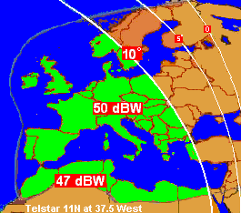
iDirect service is available in this Europe beam
Companies offering service:
Isotropic iDirect service
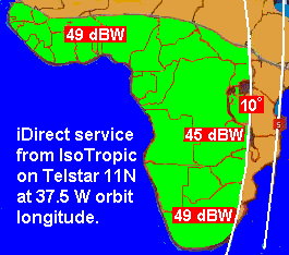
Service is available in this Africa beam
Companies offering service:
Isotropic iDirect service,
Bentley Walker Hughes HX service
The operating position is 37.5W orbit longitude.
I am hoping to find the global beam beacons at:
11199.25 V
11198.25 H
11699.50 V
11698.50 H
but have not yet done so. Maybe my dish is not pointed correctly.
If anyone can see these beacons please tell me the details and maybe send me a spectrum plot..
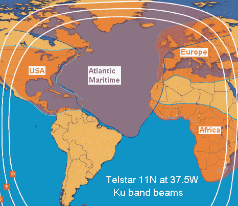
Note the Atlantic Oceanic maritime and aeronautical coverage beam. IsoTropic offer to provide iDirect service service in this beam, coupled with tracking antennas mounted on ships.
|
Page started 18 April 2009, amended 19 Oct 2025 |